
DATA AND METHOD
The data behind every answer
Public, authoritative sources. One method, applied the same way to every address. Clear about what it does not cover.
COVERAGE
Five metro areas today
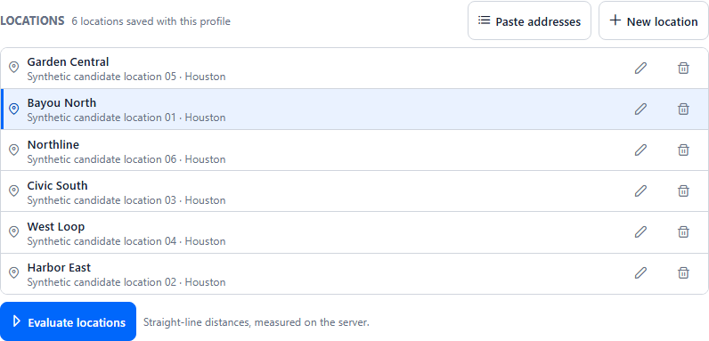
ConstaSite has place data for these coverage areas.

Houston
Coverage area

Dallas–Fort Worth
Coverage area

Austin
Coverage area

Atlanta
Coverage area

Phoenix
Coverage area
OUTSIDE COVERAGE
If we don’t cover it, we say so
When an address falls outside a coverage area, ConstaSite tells you plainly, for example “We don’t cover this city yet.” You never get a thin answer dressed up as a full one.
SOURCES
Public, authoritative sources
Each source contributes one part of the picture.
- USDA SNAP retailer dataStores authorized to accept SNAP, used to find grocery stores.
- Overture Maps placesEveryday places such as pharmacies, coffee shops and gyms.
- NPPES provider registryThe national registry of healthcare providers, used for care locations.
- PAD-US protected areasPark and protected-area boundaries, used to measure park area.
- U.S. Census TIGEROfficial geographic boundaries used to place addresses and coverage areas.
- WikidataBrand identity, used to confirm which brand a place belongs to.
METHOD
How every answer is made
Straight-line distance
Distance is measured in a straight line from the address to the place, and every result says so. It is not a driving or walking route.
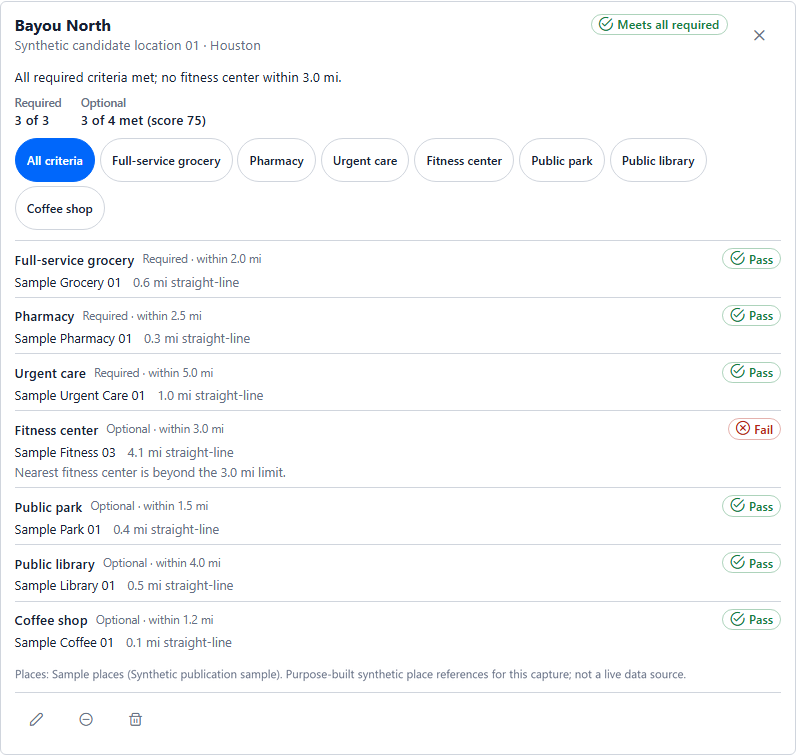
Real ConstaSite interface · synthetic data The nearest matching place
For each rule, ConstaSite finds the nearest place that matches it and shows its name, its address and its distance.
Real ConstaSite interface · synthetic data Brands, named and recorded
Every match is named by brand and located, and ConstaSite records how confidently the brand was recognized.
Real ConstaSite interface · synthetic data Substitutes, never silent
When a brand isn’t in the area, ConstaSite can use a substitute you named. The result always states that a substitute was used.
Pass · 0.8 mi to nearest grocery
Real ConstaSite interface · synthetic data Place data as of a date
Every result is stamped “place data as of” the date the data was captured, so you know how current it is.
Pass · 0.8 mi to nearest grocery
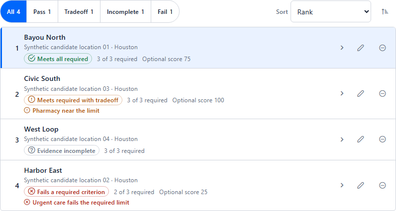
Real ConstaSite interface · synthetic data Incomplete is not Fail
Fail means a must-have is not met. Incomplete means the data needed to answer a rule is missing. ConstaSite never turns a gap into a guess.
Pass · 0.8 mi to nearest grocery
Real ConstaSite interface · synthetic data

WHAT WE DO NOT DO YET
Clear about the limits
ConstaSite answers one question well: are the places you need near each address? It does not do the following today.
- Travel time or traffic
- Demographics
- Zoning
- Reviews or ratings
- AI recommendations
Questions about data and method
Where does the place data come from?
From public, authoritative sources: USDA SNAP retailer data, Overture Maps places, the NPPES provider registry, PAD-US protected areas and U.S. Census TIGER, with Wikidata used to confirm brand identity.
What is straight-line distance, and why use it?
It is the direct distance between two points on the map, not a driving or walking route. It is the same for every address and easy to check, so results compare cleanly. ConstaSite always labels distances as straight-line.
What happens when data is missing?
The address is marked Incomplete. ConstaSite never turns missing data into a guessed Pass or Fail, so you can see exactly where the gap is.
How current is the place data?
Every result is stamped with the date of the place data behind it, shown as “place data as of” that date. You always know how old the answer is.
What does ConstaSite not do?
It does not estimate travel time or traffic, and it does not cover demographics, zoning, or reviews and ratings. It does not make AI recommendations. It answers one question well: are the places you need near each address?
Which areas are covered?
Place data covers five metro areas today: Houston, Dallas–Fort Worth, Austin, Atlanta and Phoenix. If an address falls outside a coverage area, ConstaSite tells you so instead of guessing.
See the method on your addresses.
Tell us the places you’re weighing. We’ll walk you through ConstaSite.
- metro areas
- 5
- addresses per check
- 25
- report